

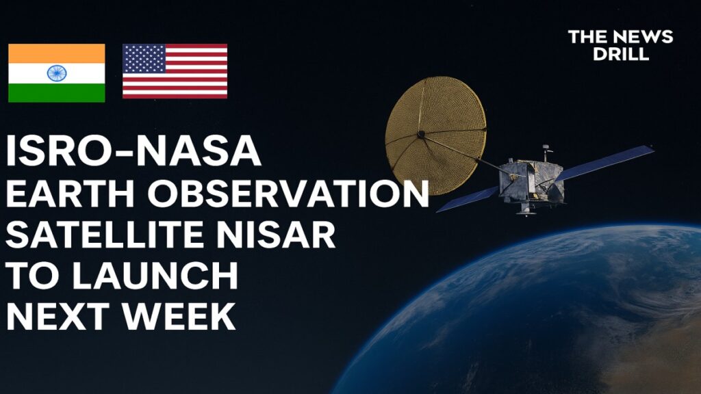
New Delhi, July 22, 2025 – The Indian Space Research Organisation (ISRO) is set to make history with the launch of the Earth Observation Satellite NISAR, a cutting edge mission jointly developed with NASA, slated for July 30, 2025, from the Satish Dhawan Space Centre in Sriharikota.
This landmark project valued at approximately US $1.5 billion marks the world’s first dual band synthetic aperture radar satellite and cements a new era of international cooperation in Earth observation. The Earth Observation Satellite NISAR is expected to be prominently featured around the globe as the mission unfolds.
What Is the Earth Observation Satellite NISAR?
Earth Observation Satellite NISAR (NASA‑ISRO Synthetic Aperture Radar) is a joint initiative combining NASA’s advanced L‑band radar with ISRO’s proven S‑band radar, enabling comprehensive, all weather, day–night monitoring of Earth’s land and ice surfaces. For the first time, this dual frequency satellite will deliver 3D radar imaging that detects changes as small as a few centimeters an unprecedented achievement in remote sensing.
Launch Details and Sequence
- Launch Date & Time: July 30, 2025, at approximately 5:40 PM IST
- Launch Vehicle: GSLV‑F16 (Mk II)
- Launch Site: Second Launch Pad, Satish Dhawan Space Centre, Sriharikota.
- Orbit & Mission Life: Sun-synchronous orbit at 747 km altitude; operational lifespan estimated at three years.
Engineers have completed integration at Bengaluru’s ISITE facility, after shipping the satellite to Sriharikota in mid-May.
Why Earth Observation Satellite NISAR Is a Game Changer
Dual‑Frequency Radar Innovation
Earth Observation Satellite NISAR is the first of its kind to combine L‑band and S‑band SAR technology. L‑band radar penetrates deep biomass such as dense forests and frozen soils, enabling subsurface insights. S‑band radar delivers higher resolution readings of surface structures ideal for urban areas, agricultural lands, and ice sheets.
Uninterrupted, All‑Weather Coverage
Unlike optical satellites, Earth Observation Satellite NISAR can operate seamlessly in all weather conditions and light levels. Its synthetic aperture radar scans nearly the entire globe every 12 days, capturing real time data without interference from clouds, smoke, or darkness.
Scientific & Societal Impact
- Disaster Management: Tracks earthquakes, landslides, tidal movements, and volcanic activity to assist timely interventions.
- Climate & Environmental Monitoring: Observes glacier retreat, polar ice fluctuations, wetlands, soil moisture, and ecosystem changes.
- Agriculture & Infrastructure: Monitors crop health, land use patterns, water resources, and coastal erosion all integral for sustainable development.
Data from the Earth Observation Satellite NISAR mission will be publicly accessible to researchers and disaster agencies worldwide, enabling global scientific insights and community beneficial, decision making.
Landmark in US–India Space Relations
This launch underscores a milestone in civil space diplomacy. NASA’s Jet Propulsion Laboratory (JPL) is providing the L‑band radar instrument, while ISRO built the satellite bus, integrated systems, and will execute the launch.
The mission aligns with a strategic vision dating back to a bilateral agreement signed in 2014; Earth Observation Satellite NISAR is among the most technologically advanced and high cost satellite ventures ever co-led by NASA and ISRO.
Road Ahead
July 21, 2025: NASA held a news preview hosted by key mission leaders Nicky Fox, Karen St. Germain, Wendy Edelstein, and Paul Rosen offering insights into technical readiness and mission objectives.
By July 30: Liftoff aboard ISRO’s GSLV-F16, initiating orbit insertion and commencement of radar payload calibration.
First 12-Day Cycle: Initial Earth surface mapping begins; data will be validated and released over following months.
Conclusion
The launch of the Earth Observation Satellite NISAR stands as a landmark achievement in space exploration, international cooperation, and Earth science. With its dual frequency radar, all weather capabilities, and high precision imaging, the mission equips humanity with a powerful tool for understanding and protecting our dynamic planet.
This high impact initiative underscores how global partnerships in space can yield tangible benefits for environmental monitoring, disaster management, and sustainable development. As the countdown begins, ISRO and NASA’s joint endeavor is set to reshape the future of Earth observation.
Stay connected with The News Drill for more updates.