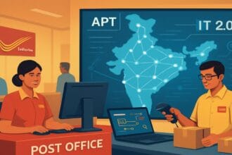

India’s logistics giant Delhivery has developed an AI-powered mapping platform using billions of delivery records. The technology is designed to improve address accuracy, commercial routing and location intelligence for businesses.
- What Is Delhivery Maps?
- How Does Delhivery Maps Work?
- 1. AI-powered geocoding
- 2. Reverse geocoding
- 3. Address validation and standardisation
- 4. Vehicle-specific route optimisation
- 5. Distance, toll and delivery-zone calculations
- What Can Businesses Use Delhivery Maps For?
- Delhivery’s AI Mapping Initiative and NVIDIA
- Is Delhivery Maps a Competitor to Google Maps?
- How Can Developers Access Delhivery Maps?
- What Does Delhivery’s Mapping Platform Mean for India’s Logistics Industry?
Indian logistics company Delhivery has entered the geospatial technology market with Delhivery Maps, an AI-powered mapping platform designed to address the challenges of India’s complex addressing system and logistics infrastructure.
Announced on June 19, 2026, the platform makes Delhivery’s proprietary mapping technology commercially available to external businesses, developers and gig-economy platforms. The infrastructure was originally developed to support the company’s nationwide parcel delivery and logistics operations.
Unlike conventional navigation applications primarily designed to help individuals travel from one location to another, Delhivery Maps focuses on business requirements such as address validation, delivery route optimisation, vehicle-specific navigation and location intelligence.
The company’s move represents an expansion beyond its traditional courier and supply chain operations into commercial geospatial technology.
More Read

What Is Delhivery Maps?
Delhivery Maps is an AI-first mapping and location-intelligence platform that provides businesses with geographical data and software tools through application programming interfaces (APIs).
The platform is designed to interpret India’s complicated address ecosystem, where locations are frequently described using landmarks, localities, informal references and incomplete address details rather than standardised street addresses.
For logistics companies, these challenges can result in incorrect delivery locations, failed delivery attempts, longer routes and increased operational costs.
Delhivery developed its mapping infrastructure to address these problems through its experience handling large-scale deliveries across India. The technology is now being offered to external businesses that require accurate location data and logistics-oriented mapping services.
According to Delhivery’s product website, its mapping infrastructure draws on more than 4 billion historical deliveries, processes over 1 billion location pings daily and covers more than 18,800 PIN codes. These are company-reported figures, not independently audited accuracy measurements.
How Does Delhivery Maps Work?
At the centre of Delhivery Maps is GeoNaksha LLM, the company’s proprietary artificial intelligence system developed to understand, organise and interpret complex Indian addresses.
The technology uses historical delivery information and location intelligence to convert informal or incomplete address descriptions into structured geographical information.
For example, a customer may enter an address containing a locality name, a nearby shop, a building description or a landmark instead of a properly formatted street address. Traditional address-processing systems may struggle with such information. Delhivery’s AI-based system is designed to interpret the available context, identify missing address components and generate more structured location data.
1. AI-powered geocoding
Geocoding converts a written address into geographical coordinates, including latitude and longitude. Delhivery’s Geocoding API uses GeoNaksha LLM to interpret informal, incomplete and misspelled Indian addresses and identify their corresponding geographical locations.
2. Reverse geocoding
Reverse geocoding works in the opposite direction. It converts geographical coordinates into human-readable addresses. This can help businesses identify the locality, neighbourhood or address associated with a particular location.
3. Address validation and standardisation
Delhivery Maps can validate, correct and standardise address information. Its technology is designed to identify missing details, correct spelling errors, interpret informal abbreviations and organise address components into a structured format. The platform also provides address verification capabilities, including checking whether Delhivery has previously visited a particular address within a specified timeframe.
4. Vehicle-specific route optimisation
One of the platform’s important features is logistics-oriented routing. The system supports different vehicle categories, including motorcycles, cars and trucks. It considers variables such as road networks, traffic conditions, turn restrictions and vehicle-specific routing requirements.
This is relevant for businesses operating mixed fleets, where the best route for a delivery motorcycle may not be suitable for a heavy commercial vehicle.
5. Distance, toll and delivery-zone calculations
The platform also offers Distance Matrix, Tolls, IsoSuite and Route Planning APIs. These tools can help businesses calculate distances between multiple locations, estimate toll expenses, identify practical delivery areas and optimise routes for multiple vehicles. Delhivery additionally offers Map Tiles and Autosuggest APIs for businesses developing their own location-aware applications.
What Can Businesses Use Delhivery Maps For?
Delhivery Maps is not restricted to courier and parcel delivery businesses. Its potential applications extend to several industries that depend on accurate location information.
- E-commerce and direct-to-consumer businesses: Online retailers can use address validation and standardisation to improve checkout information and potentially reduce failed deliveries.
- Quick-commerce and food delivery: Delivery platforms can use location intelligence and vehicle-aware routing to improve delivery planning, rider allocation and estimated arrival times.
- Logistics and courier companies: Businesses can use route planning, address verification, distance calculations and visit verification to improve last-mile operations.
- Ride-hailing and mobility platforms: Location intelligence can support pickup matching, navigation and more reliable estimated arrival times.
- Financial services and fintech: Address validation and geocoding can assist businesses with location verification and customer onboarding processes.
The platform’s potential customer base therefore extends well beyond Delhivery’s existing logistics clients.
Delhivery’s AI Mapping Initiative and NVIDIA
Delhivery’s mapping initiative was also preceded by an announcement involving NVIDIA.
On February 19, 2026, Delhivery announced that it was advancing the development of AI-powered digital mapping solutions with NVIDIA to address India’s complex geography and addressing systems.
The company said it intended to leverage NVIDIA accelerated computing, CV-CUDA and NVIDIA Nemotron open models, alongside its proprietary logistics data.
The proposed capabilities included distinguishing between phonetically similar addresses, interpreting unstructured location descriptions and optimising last-mile routes in densely populated and unplanned urban areas.
The June launch of Delhivery Maps subsequently made the company’s mapping infrastructure commercially available to external users.
Is Delhivery Maps a Competitor to Google Maps?
Delhivery Maps operates in the broader mapping and geospatial technology market, but it is important to understand its intended purpose.
Google Maps is widely used for consumer navigation, while enterprise mapping platforms also provide location APIs, routing and geospatial services. India’s MapmyIndia, through its Mappls platform, is another established participant in this market.
Delhivery’s strategy is more specialised. Its proposed differentiation comes from years of commercial delivery data, including actual delivery locations, vehicle movement, address histories and logistics-specific routing requirements.
This gives the company an opportunity to compete in enterprise location intelligence rather than simply launching another general-purpose navigation application.
Delhivery has also stated that its proprietary mapping infrastructure has replaced third-party map providers across its own nationwide logistics network. Whether its technology can attract significant external adoption will depend on factors such as accuracy, pricing, API performance and integration with existing business systems.
How Can Developers Access Delhivery Maps?
Delhivery has made its mapping services available through a developer platform containing API documentation and an interactive playground.
Developers can explore services such as geocoding, reverse geocoding, address validation, routing and distance calculations. The company also provides a facility to test core APIs through its online playground.
Its developer portal additionally documents a Model Context Protocol (MCP) server that allows compatible AI applications and agents to access selected mapping services.
Businesses interested in commercial integration can contact Delhivery for product information, pricing and implementation support.
Developers can explore the platform through the official Delhivery Maps website and its developer portal.
What Does Delhivery’s Mapping Platform Mean for India’s Logistics Industry?
India’s logistics sector depends heavily on accurate location information. The country’s combination of rapidly expanding urban areas, informal addresses, local landmarks and complex road networks creates challenges for businesses operating large delivery fleets.
For a company handling millions of deliveries, even relatively small improvements in address accuracy and route planning could have meaningful operational benefits.
Delhivery is attempting to convert the location intelligence developed through its existing logistics network into a technology product that other businesses can also use.
The commercial success of Delhivery Maps will ultimately depend on whether external businesses find its services sufficiently accurate, cost-effective and reliable compared with existing mapping providers.
Nevertheless, the launch marks a significant strategic development for the company: Delhivery is moving beyond transporting parcels and seeking a role in the digital infrastructure that helps businesses locate, navigate and deliver them.
The News Drill | Technology and Business